 |
Maps of Paris for tourists and travellers: downloadable, printable and online |
|
||||||
You are here:
|
|
|
||||||||||||||||||
|
Maps of ParisThe Ultimate Google Paris Metro Map However all is not lost! The RATP website has a flashy interactive map that can help, in English too: RATP Interactive Map The top menu has instructions for use. Basically, click the starting point and finishing destination, and it shows you the possible routes. You can do other things too. Zoomable Hot-Map of Paris The RATP website also has some maps for printing out, good for residents and tourists: 
And also the City of Paris site:
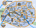
Walking Tours and Routes around ParisParisinfo has 12 themed walks around Paris (really groups of tourist attractions), and you can download PDFs: 12 Themed Walks And if you're looking for walking tours and routes around Paris, I can't do better than to recommend The Discover Walks team : they are a group of "young, educated and fun locals" who "walk you around their native city" for 60-100 minutes. They run small groups of 8 or 9, and the system works based on tips. They do give you a guideline average (e.g. the average for "Paris Landmarks" is 13 euros). Usually, you just meet up at the right place and time, but it's possible to book a private walk as well. They also do a few other paid and booked walks/tours. I found their FAQs quite refreshing and useful: Discover Walks FAQ Here's a PDF of their 2013 winter brochure: Discover Walks and here are some links to their walks:
TRAVEL TO PARIS WITH US: PHOTO HIGHLIGHTS |
|
||||||||||||||||
|
||||||||||||||||||
Travesignposts Pty Ltd This web
site copyright 2015 Travelsignposts Pty Ltd |